|
| at: |
Tuskegee National Forest |
Data from USFS GIS
 show on map
 animate
Trail users:


Elevation Profile
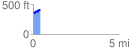
 0.404762 mi
 76.70 ft
 44.48 ft
 32.22 ft
 3.59 %
GPX Downloads: Track Route
![]()
|
| at: |
Tuskegee National Forest |
show on map
animate
0.404762 mi
76.70 ft
44.48 ft
32.22 ft
3.59 %