|
| at: |
Tuskegee National Forest |
Data from USFS GIS
 show on map
 animate
Trail users:


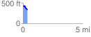
Elevation Profile
 0.369379 mi
 29.84 ft
 108.22 ft
 -78.38 ft
 5.55 %
GPX Downloads: Track Route
![]()
|
| at: |
Tuskegee National Forest |
show on map
animate
0.369379 mi
29.84 ft
108.22 ft
-78.38 ft
5.55 %