|
| at: |
Conecuh National Forest |
Data from USFS GIS
 show on map
 animate
Trail users:


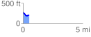
Elevation Profile
 0.521156 mi
 20.79 ft
 94.80 ft
 -74.00 ft
 3.44 %
GPX Downloads: Track Route
![]()
|
| at: |
Conecuh National Forest |
show on map
animate
0.521156 mi
20.79 ft
94.80 ft
-74.00 ft
3.44 %