|
| at: |
Conecuh National Forest |
Data from USFS GIS
 show on map
 animate
Trail users:


Elevation Profile
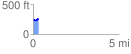
 0.308369 mi
 23.24 ft
 25.79 ft
 -2.55 ft
 1.58 %
GPX Downloads: Track Route
![]()
|
| at: |
Conecuh National Forest |
show on map
animate
0.308369 mi
23.24 ft
25.79 ft
-2.55 ft
1.58 %