|
| at: |
Conecuh National Forest |
Data from USFS GIS
 show on map
 animate
Trail users:


Elevation Profile
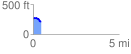
 0.455220 mi
 23.16 ft
 61.64 ft
 -38.48 ft
 2.56 %
GPX Downloads: Track Route
![]()
|
| at: |
Conecuh National Forest |
show on map
animate
0.455220 mi
23.16 ft
61.64 ft
-38.48 ft
2.56 %