|
| at: |
Conecuh National Forest |
Data from USFS GIS
 show on map
 animate
Trail users:


Elevation Profile
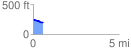
 0.559958 mi
 2.87 ft
 58.15 ft
 -55.28 ft
 1.97 %
GPX Downloads: Track Route
![]()
|
| at: |
Conecuh National Forest |
show on map
animate
0.559958 mi
2.87 ft
58.15 ft
-55.28 ft
1.97 %