|
| at: |
Bankhead National Forest |
Data from USFS GIS
 show on map
 animate
Trail users:


Elevation Profile
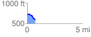
 0.703192 mi
 22.34 ft
 124.36 ft
 -102.03 ft
 3.35 %
GPX Downloads: Track Route
![]()
|
| at: |
Bankhead National Forest |
show on map
animate
0.703192 mi
22.34 ft
124.36 ft
-102.03 ft
3.35 %