|
| at: |
Bankhead National Forest |
Data from USFS GIS
 show on map
 animate
Trail users:


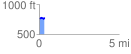
Elevation Profile
 0.330944 mi
 37.10 ft
 29.37 ft
 7.73 ft
 2.12 %
GPX Downloads: Track Route
![]()
|
| at: |
Bankhead National Forest |
show on map
animate
0.330944 mi
37.10 ft
29.37 ft
7.73 ft
2.12 %