|
| at: |
Bankhead National Forest |
Data from USFS GIS
 show on map
 animate
Trail users:


Elevation Profile
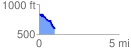
 0.961080 mi
 70.61 ft
 318.32 ft
 -247.71 ft
 6.27 %
GPX Downloads: Track Route
![]()
|
| at: |
Bankhead National Forest |
show on map
animate
0.961080 mi
70.61 ft
318.32 ft
-247.71 ft
6.27 %