|
| at: |
Bankhead National Forest |
Data from USFS GIS
 show on map
 animate
Trail users:


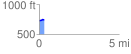
Elevation Profile
 0.314344 mi
 18.65 ft
 12.79 ft
 5.86 ft
 1.12 %
GPX Downloads: Track Route
![]()
|
| at: |
Bankhead National Forest |
show on map
animate
0.314344 mi
18.65 ft
12.79 ft
5.86 ft
1.12 %