|
| at: |
Bankhead National Forest |
Data from USFS GIS
 show on map
 animate
Trail users:


Elevation Profile
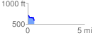
 0.592972 mi
 25.64 ft
 149.93 ft
 -124.29 ft
 4.79 %
GPX Downloads: Track Route
![]()
|
| at: |
Bankhead National Forest |
show on map
animate
0.592972 mi
25.64 ft
149.93 ft
-124.29 ft
4.79 %