|
| at: |
Bankhead National Forest |
Data from USFS GIS
 show on map
 animate
Trail users:


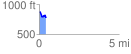
Elevation Profile
 0.429448 mi
 23.04 ft
 126.89 ft
 -103.84 ft
 5.60 %
GPX Downloads: Track Route
![]()
|
| at: |
Bankhead National Forest |
show on map
animate
0.429448 mi
23.04 ft
126.89 ft
-103.84 ft
5.60 %