|
| at: |
Bankhead National Forest |
Data from USFS GIS
 show on map
 animate
Trail users:


Elevation Profile
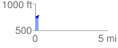
 0.218769 mi
 62.08 ft
 30.73 ft
 31.35 ft
 5.37 %
GPX Downloads: Track Route
![]()
|
| at: |
Bankhead National Forest |
show on map
animate
0.218769 mi
62.08 ft
30.73 ft
31.35 ft
5.37 %