|
| at: |
Bankhead National Forest |
Data from USFS GIS
 show on map
 animate
Trail users:


Elevation Profile
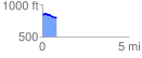
 0.816393 mi
 40.23 ft
 100.47 ft
 -60.24 ft
 2.33 %
GPX Downloads: Track Route
![]()
|
| at: |
Bankhead National Forest |
show on map
animate
0.816393 mi
40.23 ft
100.47 ft
-60.24 ft
2.33 %