|
| at: |
Bankhead National Forest |
Data from USFS GIS
 show on map
 animate
Trail users:


Elevation Profile
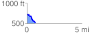
 0.789908 mi
 41.49 ft
 238.83 ft
 -197.34 ft
 5.73 %
GPX Downloads: Track Route
![]()
|
| at: |
Bankhead National Forest |
show on map
animate
0.789908 mi
41.49 ft
238.83 ft
-197.34 ft
5.73 %