|
| at: |
Bankhead National Forest |
Data from USFS GIS
 show on map
 animate
Trail users:


Elevation Profile
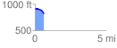
 0.618305 mi
 19.13 ft
 119.32 ft
 -100.20 ft
 3.66 %
GPX Downloads: Track Route
![]()
|
| at: |
Bankhead National Forest |
show on map
animate
0.618305 mi
19.13 ft
119.32 ft
-100.20 ft
3.66 %