|
| at: |
Bankhead National Forest |
Data from USFS GIS
 show on map
 animate
Trail users:


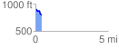
Elevation Profile
 0.409547 mi
 7.10 ft
 116.21 ft
 -109.11 ft
 5.37 %
GPX Downloads: Track Route
![]()
|
| at: |
Bankhead National Forest |
show on map
animate
0.409547 mi
7.10 ft
116.21 ft
-109.11 ft
5.37 %