|
| at: |
Bankhead National Forest |
Data from USFS GIS
 show on map
 animate
Trail users:


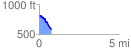
Elevation Profile
 0.799483 mi
 10.53 ft
 245.27 ft
 -234.74 ft
 5.81 %
GPX Downloads: Track Route
![]()
|
| at: |
Bankhead National Forest |
show on map
animate
0.799483 mi
10.53 ft
245.27 ft
-234.74 ft
5.81 %