|
| at: |
Bankhead National Forest |
Data from USFS GIS
 show on map
 animate
Trail users:


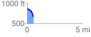
Elevation Profile
 0.584797 mi
 16.52 ft
 195.17 ft
 -178.66 ft
 6.32 %
GPX Downloads: Track Route
![]()
|
| at: |
Bankhead National Forest |
show on map
animate
0.584797 mi
16.52 ft
195.17 ft
-178.66 ft
6.32 %