|
| at: |
Bankhead National Forest |
Data from USFS GIS
 show on map
 animate
Trail users:


Elevation Profile
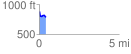
 0.435396 mi
 16.66 ft
 118.92 ft
 -102.27 ft
 5.17 %
GPX Downloads: Track Route
![]()
|
| at: |
Bankhead National Forest |
show on map
animate
0.435396 mi
16.66 ft
118.92 ft
-102.27 ft
5.17 %