|
| at: |
Bankhead National Forest |
Data from USFS GIS
 show on map
 animate
Trail users:


Elevation Profile
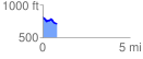
 0.820729 mi
 48.24 ft
 144.79 ft
 -96.54 ft
 3.34 %
GPX Downloads: Track Route
![]()
|
| at: |
Bankhead National Forest |
show on map
animate
0.820729 mi
48.24 ft
144.79 ft
-96.54 ft
3.34 %