|
| at: |
Talladega National Forest |
Data from USFS GIS
 show on map
 animate
Trail users:


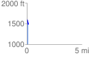
Elevation Profile
 0.139834 mi
 0.00 ft
 131.98 ft
 -131.98 ft
 17.88 %
GPX Downloads: Track Route
![]()
|
| at: |
Talladega National Forest |
show on map
animate
0.139834 mi
0.00 ft
131.98 ft
-131.98 ft
17.88 %