|
| at: |
Talladega National Forest |
Data from USFS GIS
 show on map
 animate
Trail users:


Elevation Profile
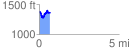
 0.692589 mi
 182.12 ft
 194.10 ft
 -11.99 ft
 5.31 %
GPX Downloads: Track Route
![]()
|
| at: |
Talladega National Forest |
show on map
animate
0.692589 mi
182.12 ft
194.10 ft
-11.99 ft
5.31 %