|
| at: |
Talladega National Forest |
Data from USFS GIS
 show on map
 animate
Trail users:


Elevation Profile
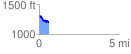
 0.600531 mi
 53.48 ft
 171.79 ft
 -118.31 ft
 5.42 %
GPX Downloads: Track Route
![]()
|
| at: |
Talladega National Forest |
show on map
animate
0.600531 mi
53.48 ft
171.79 ft
-118.31 ft
5.42 %