|
| at: |
Talladega National Forest |
Data from USFS GIS
 show on map
 animate
Trail users:


Elevation Profile
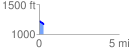
 0.278614 mi
 9.61 ft
 58.83 ft
 -49.22 ft
 4.00 %
GPX Downloads: Track Route
![]()
|
| at: |
Talladega National Forest |
show on map
animate
0.278614 mi
9.61 ft
58.83 ft
-49.22 ft
4.00 %