|
| at: |
Talladega National Forest |
Data from USFS GIS
 show on map
 animate
Trail users:


Elevation Profile
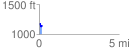
 0.174936 mi
 35.33 ft
 52.82 ft
 -17.49 ft
 5.72 %
GPX Downloads: Track Route
![]()
|
| at: |
Talladega National Forest |
show on map
animate
0.174936 mi
35.33 ft
52.82 ft
-17.49 ft
5.72 %