|
| at: |
Talladega National Forest |
Data from USFS GIS
 show on map
 animate
Trail users:


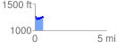
Elevation Profile
 0.563664 mi
 88.23 ft
 102.37 ft
 -14.14 ft
 3.44 %
GPX Downloads: Track Route
![]()
|
| at: |
Talladega National Forest |
show on map
animate
0.563664 mi
88.23 ft
102.37 ft
-14.14 ft
3.44 %