|
| at: |
Talladega National Forest |
Data from USFS GIS
 show on map
 animate
Trail users:


Elevation Profile
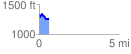
 0.613389 mi
 65.49 ft
 147.43 ft
 -81.94 ft
 4.55 %
GPX Downloads: Track Route
![]()
|
| at: |
Talladega National Forest |
show on map
animate
0.613389 mi
65.49 ft
147.43 ft
-81.94 ft
4.55 %