|
| at: |
Talladega National Forest |
Data from USFS GIS
 show on map
 animate
Trail users:


Elevation Profile
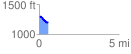
 0.552869 mi
 30.98 ft
 110.55 ft
 -79.57 ft
 3.79 %
GPX Downloads: Track Route
![]()
|
| at: |
Talladega National Forest |
show on map
animate
0.552869 mi
30.98 ft
110.55 ft
-79.57 ft
3.79 %