|
| at: |
Blue Ridge WMA Bull/Jake Mountain |
Data from David Muse
 show on map
 animate
This road is physically marked 28G but USFS GIS data shows it as both 28G and 28F.
Trail users:


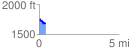
Elevation Profile
 0.425863 mi
 53.16 ft
 112.78 ft
 -59.62 ft
 5.02 %
GPX Downloads: Track Route