|
| at: |
Talladega National Forest |
Data from USFS GIS
 show on map
 animate
Trail users:


Elevation Profile
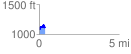
 0.362733 mi
 119.98 ft
 106.15 ft
 13.83 ft
 6.26 %
GPX Downloads: Track Route
![]()
|
| at: |
Talladega National Forest |
show on map
animate
0.362733 mi
119.98 ft
106.15 ft
13.83 ft
6.26 %