|
| at: |
Talladega National Forest |
Data from USFS GIS
 show on map
 animate
Trail users:


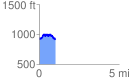
Elevation Profile
 1.025071 mi
 228.70 ft
 231.32 ft
 -2.62 ft
 4.27 %
GPX Downloads: Track Route
![]()
|
| at: |
Talladega National Forest |
show on map
animate
1.025071 mi
228.70 ft
231.32 ft
-2.62 ft
4.27 %