|
| at: |
Talladega National Forest |
Data from USFS GIS
 show on map
 animate
Trail users:


Elevation Profile
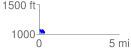
 0.330928 mi
 54.81 ft
 128.90 ft
 -74.08 ft
 7.38 %
GPX Downloads: Track Route
![]()
|
| at: |
Talladega National Forest |
show on map
animate
0.330928 mi
54.81 ft
128.90 ft
-74.08 ft
7.38 %