|
| at: |
Talladega National Forest |
Data from USFS GIS
 show on map
 animate
Trail users:


Elevation Profile
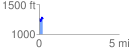
 0.232760 mi
 95.94 ft
 65.47 ft
 30.46 ft
 7.81 %
GPX Downloads: Track Route
![]()
|
| at: |
Talladega National Forest |
show on map
animate
0.232760 mi
95.94 ft
65.47 ft
30.46 ft
7.81 %