|
| at: |
Talladega National Forest |
Data from USFS GIS
 show on map
 animate
Trail users:


Elevation Profile
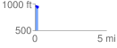
 0.233882 mi
 54.09 ft
 40.68 ft
 13.41 ft
 4.38 %
GPX Downloads: Track Route
![]()
|
| at: |
Talladega National Forest |
show on map
animate
0.233882 mi
54.09 ft
40.68 ft
13.41 ft
4.38 %