|
| at: |
Talladega National Forest |
Data from USFS GIS
 show on map
 animate
Trail users:


Elevation Profile
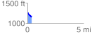
 0.386088 mi
 29.18 ft
 114.79 ft
 -85.61 ft
 5.63 %
GPX Downloads: Track Route
![]()
|
| at: |
Talladega National Forest |
show on map
animate
0.386088 mi
29.18 ft
114.79 ft
-85.61 ft
5.63 %