|
| at: |
Talladega National Forest |
Data from USFS GIS
 show on map
 animate
Trail users:


Elevation Profile
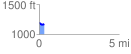
 0.319621 mi
 24.41 ft
 53.55 ft
 -29.14 ft
 3.17 %
GPX Downloads: Track Route
![]()
|
| at: |
Talladega National Forest |
show on map
animate
0.319621 mi
24.41 ft
53.55 ft
-29.14 ft
3.17 %