|
| at: |
Talladega National Forest |
Data from USFS GIS
 show on map
 animate
Trail users:


Elevation Profile
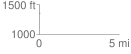
 0.048880 mi
 11.35 ft
 3.07 ft
 8.28 ft
 4.40 %
GPX Downloads: Track Route
![]()
|
| at: |
Talladega National Forest |
show on map
animate
0.048880 mi
11.35 ft
3.07 ft
8.28 ft
4.40 %