|
| at: |
Talladega National Forest |
Data from USFS GIS
 show on map
 animate
Trail users:


Elevation Profile
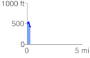
 0.330474 mi
 53.57 ft
 119.44 ft
 -65.87 ft
 6.85 %
GPX Downloads: Track Route
![]()
|
| at: |
Talladega National Forest |
show on map
animate
0.330474 mi
53.57 ft
119.44 ft
-65.87 ft
6.85 %