|
| at: |
Talladega National Forest |
Data from USFS GIS
 show on map
 animate
Trail users:


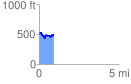
Elevation Profile
 0.910708 mi
 144.21 ft
 141.22 ft
 2.99 ft
 3.00 %
GPX Downloads: Track Route
![]()
|
| at: |
Talladega National Forest |
show on map
animate
0.910708 mi
144.21 ft
141.22 ft
2.99 ft
3.00 %