|
| at: |
Talladega National Forest |
Data from USFS GIS
 show on map
 animate
Trail users:


Elevation Profile
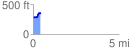
 0.442280 mi
 88.16 ft
 27.14 ft
 61.01 ft
 3.78 %
GPX Downloads: Track Route
![]()
|
| at: |
Talladega National Forest |
show on map
animate
0.442280 mi
88.16 ft
27.14 ft
61.01 ft
3.78 %