|
| at: |
Talladega National Forest |
Data from USFS GIS
 show on map
 animate
Trail users:


Elevation Profile
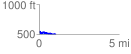
 1.039749 mi
 57.68 ft
 114.89 ft
 -57.20 ft
 2.09 %
GPX Downloads: Track Route
![]()
|
| at: |
Talladega National Forest |
show on map
animate
1.039749 mi
57.68 ft
114.89 ft
-57.20 ft
2.09 %