|
| at: |
Talladega National Forest |
Data from USFS GIS
 show on map
 animate
Trail users:


Elevation Profile
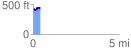
 0.416759 mi
 54.05 ft
 34.25 ft
 19.80 ft
 2.46 %
GPX Downloads: Track Route
![]()
|
| at: |
Talladega National Forest |
show on map
animate
0.416759 mi
54.05 ft
34.25 ft
19.80 ft
2.46 %