|
| at: |
Talladega National Forest |
Data from USFS GIS
 show on map
 animate
Trail users:


Elevation Profile
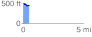
 0.493811 mi
 41.62 ft
 110.74 ft
 -69.12 ft
 4.25 %
GPX Downloads: Track Route
![]()
|
| at: |
Talladega National Forest |
show on map
animate
0.493811 mi
41.62 ft
110.74 ft
-69.12 ft
4.25 %