| at: |
Talladega National Forest |
Data from USFS GIS
 show on map
 animate
Trail users:


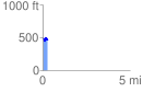
Elevation Profile
 0.291520 mi
 60.25 ft
 76.93 ft
 -16.68 ft
 5.00 %
GPX Downloads: Track Route
![]()
| at: |
Talladega National Forest |
show on map
animate
0.291520 mi
60.25 ft
76.93 ft
-16.68 ft
5.00 %