|
| at: |
Talladega National Forest |
Data from USFS GIS
 show on map
 animate
Trail users:


Elevation Profile
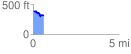
 0.616073 mi
 60.01 ft
 134.22 ft
 -74.22 ft
 4.13 %
GPX Downloads: Track Route
![]()
|
| at: |
Talladega National Forest |
show on map
animate
0.616073 mi
60.01 ft
134.22 ft
-74.22 ft
4.13 %