|
| at: |
Talladega National Forest |
Data from USFS GIS
 show on map
 animate
Trail users:


Elevation Profile
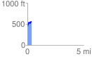
 0.388045 mi
 140.92 ft
 26.10 ft
 114.82 ft
 6.88 %
GPX Downloads: Track Route
![]()
|
| at: |
Talladega National Forest |
show on map
animate
0.388045 mi
140.92 ft
26.10 ft
114.82 ft
6.88 %