|
| at: |
Talladega National Forest |
Data from USFS GIS
 show on map
 animate
Trail users:


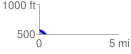
Elevation Profile
 0.424433 mi
 71.27 ft
 158.03 ft
 -86.76 ft
 7.05 %
GPX Downloads: Track Route
![]()
|
| at: |
Talladega National Forest |
show on map
animate
0.424433 mi
71.27 ft
158.03 ft
-86.76 ft
7.05 %