|
| at: |
Talladega National Forest |
Data from USFS GIS
 show on map
 animate
Trail users:


Elevation Profile
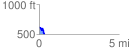
 0.331963 mi
 44.96 ft
 156.88 ft
 -111.92 ft
 8.95 %
GPX Downloads: Track Route
![]()
|
| at: |
Talladega National Forest |
show on map
animate
0.331963 mi
44.96 ft
156.88 ft
-111.92 ft
8.95 %