|
| at: |
Talladega National Forest |
Data from USFS GIS
 show on map
 animate
Trail users:


Elevation Profile
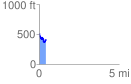
 0.449317 mi
 74.43 ft
 176.15 ft
 -101.72 ft
 7.42 %
GPX Downloads: Track Route
![]()
|
| at: |
Talladega National Forest |
show on map
animate
0.449317 mi
74.43 ft
176.15 ft
-101.72 ft
7.42 %